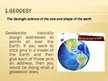
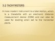
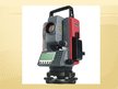
Geodesy
Geodesists basically assign addresses to points all over the Earth. If you were to stick pins in a model of the Earth and then give each of those pins an address, then you would be doing what a geodesist does.
Geodetic subdivisions:
Higher geodesy
Geodesy or topography
Measuring
Cartography
engineergeodesy.
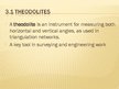
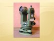
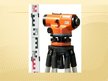
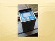
Theodolites
A theodolite is an instrument for measuring both horizontal and vertical angles, as used in triangulation networks.
A key tool in surveying and engineering work.…